From rerdm
(Difference between revisions)
|
|
| Line 64: |
Line 64: |
| | <div style="float:left; width: 270px; height 152px; border:0px;" align="center"> | | <div style="float:left; width: 270px; height 152px; border:0px;" align="center"> |
| | [[File:E10.jpg|270px]] | | [[File:E10.jpg|270px]] |
| | + | </div> |
| | + | <div style="float:left; width: 270px; height 152px; margin-right:20px; border:0px;" align="center"> |
| | + | [[File:F1.jpg|270px]] |
| | + | </div> |
| | + | <div style="float:left; width: 270px; height 152px; margin-right:20px; border:0px;" align="center"> |
| | + | [[File:F2.jpg|270px]] |
| | + | </div> |
| | + | <div style="float:left; width: 270px; height 152px; border:0px;" align="center"> |
| | + | [[File:F3.jpg|270px]] |
| | </div> | | </div> |
| | </div> | | </div> |
Revision as of 16:46, 8 December 2012
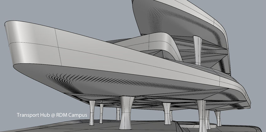
Transport Hub
author(s):Wenjia Wang, Yuxiao
Summary
As all projects are being worked on under a tight schedule, we can expect the busy and glorious scene at this port. After getting through all interactions study, we have decided to set a multifunctional transport hub here, aiming not only to provide the campus with good infrastructural quality, also serving all our fellow projects.
We've programmed all the transport activities, including timetable and the number of passengers, according to the specific needs of this area. Different transports and passengers arrive at the hub on various levels. The whole hub should be an integral space and system without unidirectional flow or restricted functional unit. In a further step, the circulation system involves linearly spiraling ramp system and closed loops. And even though the activities are tentatively planed for the situation from now to 15 years in the future, the building should allow for altering and upgrading.
After the second round design, we have confirmed the hub will locate at the north edge of the site, just outside the shoreline. Ferry, yacht, cruise ferry, the "island", helicopter, bike, pedestrian reach the hub on different levels. The hub connects directly to "Continuality" to the south and uses this landscape as land connection. At last the problem will fall into the coordination between levels, flows and how the structure and space can cooperate with them.
Connections
Continuality, Islands
Error creating thumbnail: Invalid thumbnail parameters
<comments/>


