project09:Interactions
Interactions between
Project-Transport(s)
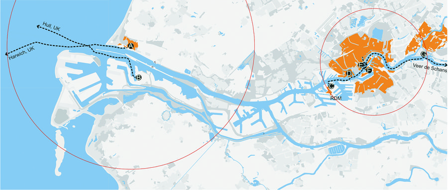
Present-ports:
A. Hook of Holland B. Rotterdam C. RDM D. Scheepvaart E. Veer Erasmusbrug F. Hotel New York G. Veer Stormpolder
Present-shipping lines:
International line A: Ferries from Hook of Holland to Harwich,UK, frequency: 1/day, time table: 2:30pm, passengers: 800
International line B: Ferries from Rotterdam to Hull,UK, frequency: 1/day, time table: 8:30pm, passengers: 600
- Inland line E-D-C: Ferries from Veer Erasmusbrug to Scheepvaart to RDM, departure at every :00 and :30, 8:00 to 10:00
Inland line E-G: Ferries from Veer Erasmusbrug to Veer Stormpolder to ......, departure at every :10 and :40, 8:10 to 10:10
Watertaxi 1: the Veerhaven and the Leuvehaven to Hotel New York, 7:00 to 0:00, 12 passengers, 60 km/h
Watertaxi 2: Maastaxi on 30 docks, 7:00 to 0:00, 12 passengers, 60 km/h
- This ferry access is the only regular shipping access on site at present.
Project-object(s)
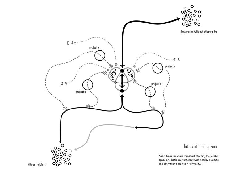
Connection to Rotterdam Heijplaat shipping line [1]
- As the Transportation Hub, this project should be connected directly and physically to the shipping line
Connection to the village Heijplaat [2]
- The Transportation Hub will assume the doorway of the village
Connection to passageway from harbour to village [3]
- The direction pedestrians come from
Connection to derelict Pier [4]
- The Pier could be re-used as part of the construction in the proposal
Project-person(s)
Connection to Vincent(engineering staff) [5]
- A engineering staff lives in Rotterdam Central. He pointed out beside a lack of commercial and entertainment functions, transportation remains as a big problem. This implies the local needs and potentials for a transportation hub.
transportation-transportation(s)
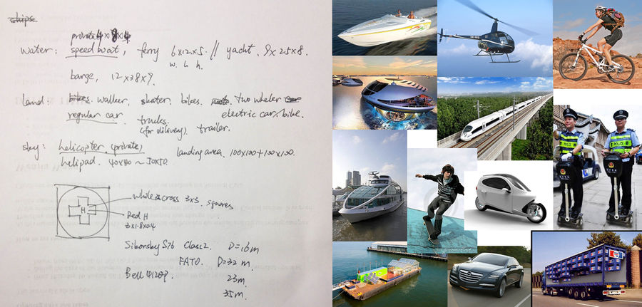
In a transport space, interactions frequently happen between different transportation. The following diagram tries to understand the feasible transport and transfer in the space.
1, land, water, sky
2, transport speed, size, amount, tide
3, public or private
4, dwell time


